


Shiloh Precinct, Miller County, Arkansas
About
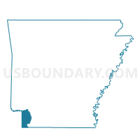
Outline

Summary
| Unique Area Identifier | 527284 |
| Name | Shiloh Precinct |
| County | Miller County |
| State | Arkansas |
| Area (square miles) | 24.70 |
| Land Area (square miles) | 24.52 |
| Water Area (square miles) | 0.18 |
| % of Land Area | 99.26 |
| % of Water Area | 0.74 |
| Latitude of the Internal Point | 33.41241190 |
| Longtitude of the Internal Point | -93.88178120 |
Maps


Graphs
Select a template below for downloading or customizing gragh for Shiloh Precinct, Miller County, Arkansas


Neighbors
Neighoring Voting District (by Name) Neighboring Voting District on the Map
- Boyd Precinct, Miller County, AR
- Central Precinct, Miller County, AR
- Garland Precinct, Miller County, AR
- Greenwich Village Precinct, Miller County, AR
- Mandeville Voting District, Miller County, AR
- Rondo Precinct, Miller County, AR
Top 10 Neighboring County Subdivision (by Population) Neighboring County Subdivision on the Map
- Garland township, Miller County, AR (33,493)
- Cleveland township, Miller County, AR (3,139)
- Red River township, Miller County, AR (307)
Top 10 Neighboring Place (by Population) Neighboring Place on the Map
Top 10 Neighboring Unified School District (by Population) Neighboring Unified School District on the Map
- Texarkana School District, AR (32,645)
- Lafayette County School District, AR (5,731)
- Genoa Central School District, AR (4,685)
Top 10 Neighboring State Legislative District Lower Chamber (by Population) Neighboring State Legislative District Lower Chamber on the Map
- State House District 1, AR (28,441)
- State House District 2, AR (25,839)
- State House District 4, AR (25,193)